|
|
Agricultural siteThe agricultural site consists of dominant annual crops composed of cereals (32.2% of area), canola (13.2%), corn (7.0%) and soybean (6.7%). Crops identification in Manitoba and the description of the main stages of development of cereals based on BBCH scale can be found here. During SMAPVEX12, 60 quarter section fields (800 x 800 m) where annual crop and pasture land cover is present will be sampled. 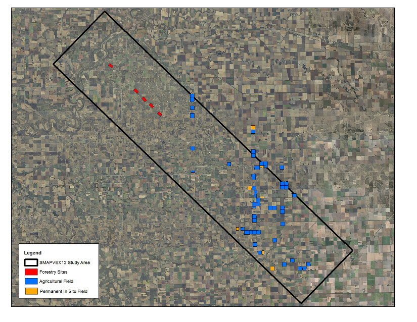
Location of cropland fields (blue) and forest sites (red) where access has been granted. The agricultural fields where the AAFC long term in situ stations are installed are identified in orange.
The agricultural site benefits from the existing AAFC permanent in situ soil moisture stations already installed in the Brunkild watershed, an on-going AAFC research site. 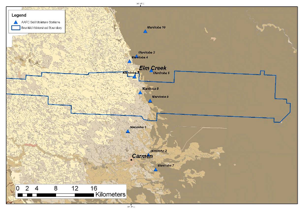
Location of the AAFC Manitoba in situ soil moisture network in the Brunkild watershed. Backdrop image shows clay dominated soils on the eastern portion of the watershed and sandier soils on the western portion of the watershed.
The AAFC network consists of nine in situ monitoring stations distributed to be representative of the different soil texture classes. Each station measures soil moisture, soil temperature and liquid precipitation, with triplicate measurements of the soil moisture and soil dielectric at each depth, and duplicate measurements of soil temperature. Soil moisture and temperature are measured horizontally at depths of 5, 20, 50 and 100 cm, with an additional three probes place vertically at the surface to capture integrated surface soil moisture over a 6 cm depth. Measurements are collected on a 30 minute time scale using Stephen’s Hydra Probes and a tipping bucket rain gauge (Campbell Scientific 700) powered by solar panels and batteries. 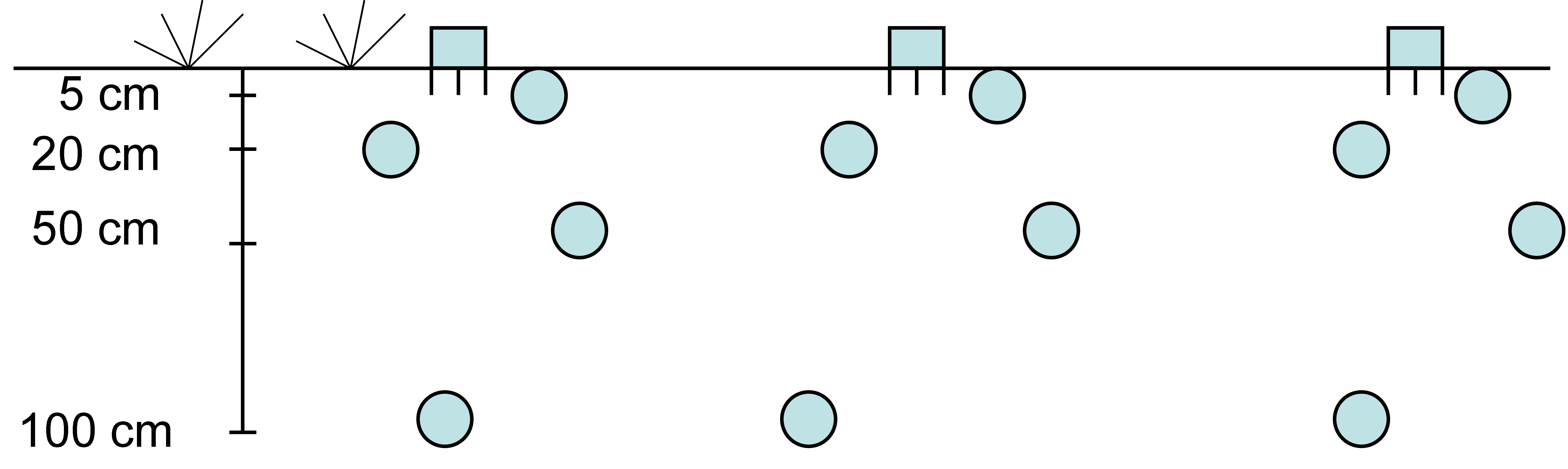
Schematic implementation of probes within each soil pit for AAFC in situ network.
|
|
|
|
|
|
|
|
|
|
|
|
|
|
|