
|
|
Flightlines: UAVSARThe Uninhabited Aerial Vehicle Synthetic Aperture Radar (UAVSAR) is an aircraft based fully polarimetric L-band radar that is also capable of interferometry. It is currently implemented on a NASA Gulfstream-III aircraft (http://uavsar.jpl.nasa.gov). For SMAPVEX, the nominal flight altitude is 13 km. UAVSAR looks to the left of flight direction and collects data over a swath between 25 and 65 degrees, which is a nominal swath of 21 km. The most relevant portion of the data swath for SMAP, which has an incidence angle of 40 degrees, will be data collected between ~35 and 45 degrees, which is a narrower swath of ~3.8 km. Four flightlines will be used, in order to provide coverage of the study domain. In addition to these lines, two additional lines will be flown to complement the low altitude PALS coverage. The coverage will be oriented to provide data with the same azimuth angle as PALS. 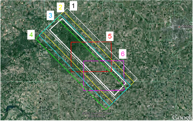
SMAPVEX12 UAVSAR Coverage Boxes (study region is the white box at center).
|
|
|
|
|
|
|
|
|
|
|
|
|
|
|