
|
|
Flightlines: PALSThe Passive/Active L-band Sensor (PALS) flightlines were designed to satisfy the major objectives of SMAPVEX 12. The PALS will be mounted at a 40 degree incidence angle looking to the rear of the aircraft; it will be augmented with additional components designed to detect and mitigate Radio Frequency Interference (RFI). During SMAPVEX12, the PALS will acquire passive and active L-band data at two elevations (Low and High) with along track spatial resolution of about 650 m and 1590 m, respectively. Geometric features of PALS data acquisitions
Low altitude lines will be used to provide high spatial resolution data for fields/sites with homogeneous vegetation conditions. Four lines were designed and the sampling sites will be located directly on these lines, to the degree possible. Low Line (LL) 1 and 2 cover a range of agricultural conditions, LL3 is focused on grassland and LL4 on forest. High altitude lines (HL) will map a larger region that will provide data for simulating SMAP combined algorithms. A total of eight lines will cover a domain ~12.8 by 70 km. Lines are spaced ~ 1.6 km apart. 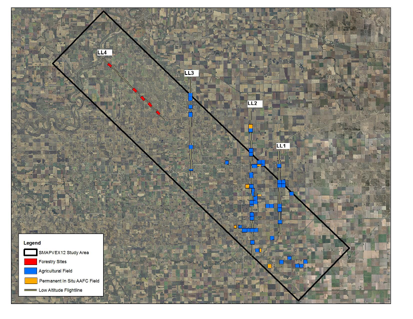
Location of low altitude PALS flight lines (in yellow) over the study region (black box).
|
|
|
|
|
|
|
|
|
|
|
|
|
|
|