|
|
Volumetric soil moistureIn addition to the data provided by AAFC in soil moisture stations, the volumetric soil moisture will be measured using hand-held hydraprobes as illustrated below, to facilitate the measurement recording electronically and on hard copy. 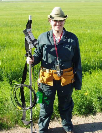
Soil moisture sampler with a holder. This setup will facilitate the capture of surface soil moisture with a hydraprobe and recording each reading electronically and on hard copy.
Surface soil moisture measurements will be collected at near surface depth (6 cm) over selected agricultural fields. To capture the soil moisture variability, the measurements will be conducted over multiple locations in each selected agricultural field. At each measurement location, a total of 3 Hydra probe readings at 6 cm depth will be taken, as shown in the figure below. 
Location of 3-replicate soil moisture acquisitions at each measurement location.
Two measurement strategies will be adopted in order to respectively assess:
Strategy 1: Flight overpass samplingIt aims to determine representative field-scale soil moisture values for the validation of L-band passive and active soil moisture retrieval algorithms. The sampling will be conducted at time close to UAVSAR and PALS airborne acquisitions. In this sampling strategy, the adopted approach maximizes the number of sample fields during the flight operations. About 40–50 fields per day will be sampled for soil moisture measurements on flight days and on SMOS and RADARSAT-2 satellite overpasses. At each field, data collection will be conducted along two transects distant of 200 m. Each transect will support eight measurement points at 75 m intervals and 3 Hydra probe readings at 6 cm depth per measurement point. 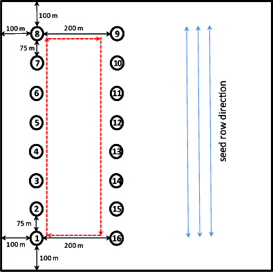
Flight overpass soil moisture sampling strategy.
Strategy 2: Intensive samplingIntensive soil moisture measurements will be conducted on two days (one in the morning and one in the afternoon), in order to:
The intensive soil moisture sampling will be conducted on a limited number of fields selected upon the availability of in situ soil moisture stations. Two grids will share common sampling locations: a 50 m grid of seven transects and seven measurement points; and a 100 m grid of seven transects and seven measurement points. There will be 3 Hydra probe readings at 6 cm depth per measurement point. 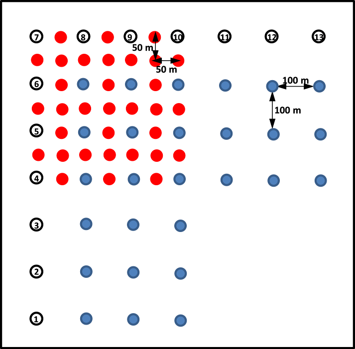
Intensive soil moisture sampling strategy.
Summary of soil moisture sampling strategies
Back |
|||||||||||||||||||||
|
|
|
|
|
|
|
|
|
|
|
|
|
|